
Bali is a Hindu island province of Indonesia about 8 degrees south of the equator, built around volcanoes, temple culture and a coastline that changes character every half hour of driving. This guide gives the entry rules as they stand (e-VOA at IDR 500,000 and the separate IDR 150,000 tourist levy), the real dry and wet seasons, how the areas differ, temple etiquette, and the safety notes that matter, from Mount Batur's mandatory guides to the Nusa Penida beaches where swimming is banned.
Quick picks
| Base | Character | Best for |
|---|---|---|
| Kuta to Canggu (south) | Beach strip by the airport | Surf, nightlife, first nights |
| Bukit Peninsula | Limestone cliffs, Uluwatu Temple | Expert surf, sunset temple |
| Ubud | Inland arts town, rice terraces | Culture, temples, slower days |
| East (Amed) | Quiet coast under Mount Agung | Snorkelling, diving, calm |
| North and west | Lovina, Pemuteran, Menjangan | Reefs, national park, few crowds |
| Nusa Penida | Cliff island, 40 min by fast boat | Viewpoints, manta snorkelling |
Where Bali is, and what shapes it
Bali is one island province of about 5,780 km2 and 4.3 million people, with Denpasar as its capital, sitting roughly 8 degrees south of the equator: tropical all year, with wet and dry seasons instead of summer and winter. Two volcanoes shape everything. Mount Agung, about 3,030 metres, is the island's spiritual axis and an active volcano: it erupted in 1963 to 1964 and again from 2017 to 2019, and Indonesia's volcanology agency (PVMBG) has held it at Level I, Normal, the lowest of four levels, since September 2021. Mount Batur (1,717 m) is the sunrise-trek volcano. Bali also sits in an active seismic zone on the Ring of Fire, so small tremors are a normal part of life; BMKG, the national meteorology and geophysics agency, is the official source for earthquake and tsunami information. Be wary of any guide that reports dramatic recent quakes: the widely copied claim of a magnitude-6.0 earthquake on 5 May 2026 does not exist in BMKG records, which show only minor tremors that day.
Entry rules and the levy
Most visitors (including the US, UK, EU and Australia) use the visa on arrival or e-VOA: IDR 500,000 for 30 days, extendable once for another 30 days at IDR 500,000. Nineteen countries, including the ASEAN states plus Brazil, Peru, Türkiye and a few others, get 30 days visa-free, and that stay cannot be extended. Separately, every foreign visitor pays the Bali tourist levy of IDR 150,000 per entry, paid in advance through the official Love Bali site (lovebali.baliprov.go.id) for a QR voucher; it is not included in the visa fee, and spot checks happen at attractions. Complete the free All Indonesia arrival card online within 72 hours before arrival; sites charging for it are scams.
Seasons: dry, wet, and the surf switch
The dry season runs roughly April or May to October, and the wet season from about November to April. Long-term climate normals for the south put January at about 281 mm of rain across 19 rainy days and August at about 41 mm, the driest month. Surf follows the winds: in the dry season the west coast breaks (Uluwatu, Padang Padang, Canggu) work best, and in the wet season the east coast (Keramas, Sanur, Nusa Dua) takes over. One 2026 wrinkle: BMKG's outlook, citing El Niño conditions, expects the coming rainy season to start late in parts of Bali, possibly not until January or February 2027, so shoulder-season trips this year may run drier than the calendar suggests. Mount Batur treks run year-round, with the best sunrise odds in the dry months.
The areas, honestly
The south strip runs from Kuta (10 to 20 minutes from the airport) through Legian and Seminyak to Canggu (40 to 60 minutes, longer in traffic): surf schools, beach clubs and the island's densest tourism. The Bukit Peninsula to the south is dry limestone: Uluwatu Temple on its cliff, expert reef breaks below, and Jimbaran's seafood bay. Ubud, 35 to 40 km inland, is the cultural base: temple towns, the Sacred Monkey Forest, rice terraces and craft villages, and the journey from the coast takes 1.5 to 2 hours in traffic despite the short distance. The east coast at Amed offers black-sand bays and the island's easiest shore snorkelling under Agung. The north (Lovina's dolphin boats at dawn) and the far west (Pemuteran's reefs and Menjangan Island inside West Bali National Park) are slower and emptier. Nusa Penida, Lembongan and Ceningan are part of Bali province: fast boats from Sanur take 30 to 45 minutes to Penida, plus a IDR 25,000 island retribution fee on arrival. For how Bali compares with the region's other islands, see our guide to the best islands in Southeast Asia.
Getting around
Ngurah Rai Airport (DPS) sits at Tuban, immediately beside the south strip. There is no train; the working system is ride-hailing apps (Grab and Gojek) for short hops, metered Blue Bird taxis, and a private car with driver hired by the day for sightseeing, which is how most visitors cover Ubud, the east or the Bukit without stress. Scooters are everywhere and cheap, and they are also the island's biggest injury risk for tourists; a helmet is not optional. Fast boats also run from Padang Bai and Serangan to Lombok and the Gili Islands in about 1.5 to 2.5 hours, with rough-sea cancellations common in the wettest months.
Temples, villages and the calendar
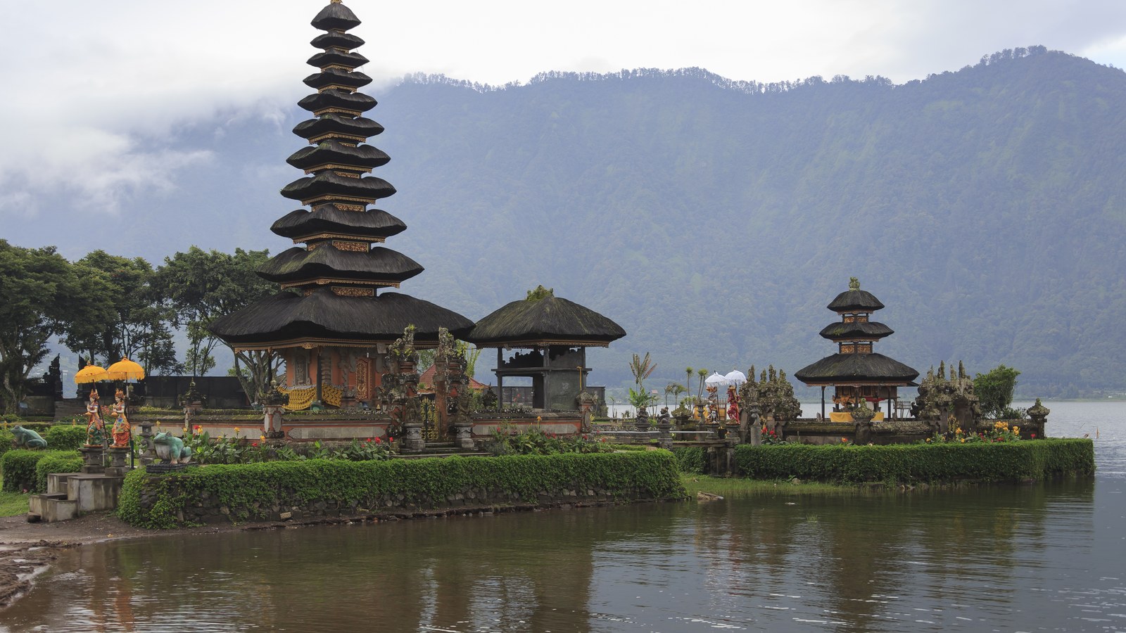
Temple visits run on rules, and guards enforce them: sarong and sash, shoulders and knees covered, and the posted restriction that menstruating women do not enter the inner sanctum, a Balinese Hindu observance applied across temples. Step around the small palm-leaf offerings (canang sari) on pavements rather than over them. Three temples anchor most itineraries: Besakih, the Mother Temple of 23 temple groups on Agung's slopes; Lempuyang in the east, whose Gate of Heaven frames Agung (foreign admission IDR 100,000, and expect a queue for the photo); and Ulun Danu Beratan, the water temple that appears to float on Lake Beratan in the Bedugul highlands. For village Bali, Penglipuran in Bangli keeps a uniform ancestral layout, bans motor vehicles from its main path and charges foreign visitors IDR 50,000. The calendar's biggest day is Nyepi, the Day of Silence (19 March 2026): the whole island, airport included, closes for 24 hours, preceded by the Ogoh-Ogoh monster parades on the eve. Galungan and Kuningan, when decorated penjor poles line every street, fell on 17 and 27 June 2026. One correction worth making: the circular terracotta house in 2026 design coverage is on Lombok, not Bali; Bali's own circular house is Villa Omah Prana.
Mount Batur, done by the rules
The Batur sunrise trek starts between 3:30 and 4:00 in the morning from trailheads like Toya Bungkah, and a registered local guide from the Batur trekking guide association is mandatory: unguided hikers are turned back at checkpoints. There is also a park permit of IDR 100,000 per person, sometimes bundled into package prices, so ask what your quote includes. The summit is 1,717 metres; even in the dry season, take a warm layer for the wait before dawn.
Money and the scams that work
Cash runs the island's warungs, markets and villages; cards work at hotels and larger restaurants. Use bank ATMs inside branches or malls, because standalone street ATMs in tourist strips are a known skimming risk. Bali's most polished con is the money changer advertising a rate too good to be true, then shortchanging the count. Use only authorised changers (the green-signed Central Kuta chain is the name locals give), count every note yourself, and never hand the stack back for a recount. For taxis, metered Blue Bird cars or the apps beat any flat fare quoted at the kerb.
Safety notes that matter
Swim with local knowledge. Echo Beach at Canggu is an intermediate-to-advanced reef break with rips, not a casual swimming beach. On Nusa Penida, Kelingking Beach is a no-swim viewpoint with a treacherous path, swimming at Angel's Billabong is banned after fatal accidents there, and Broken Beach has no water access at all; people have died at all three by treating them as photo backdrops first. Rabies is present on Bali: do not feed or handle stray dogs or monkeys (the Monkey Forest and Uluwatu are common exposure spots), discuss pre-travel vaccination with a doctor, and if you are bitten or scratched, wash the wound under running water with soap for 15 minutes and get to a clinic the same day for post-exposure treatment. For volcanoes and earthquakes, check the live official sources before you travel: MAGMA Indonesia for volcano alert levels and BMKG for seismic activity.
Sources
- BMKG: Indonesia meteorology, climatology and geophysics agency
- MAGMA Indonesia: official volcano monitoring
- Love Bali: official tourist levy payment
- All Indonesia: official arrival card
- Indonesia Travel: official tourism portal
- Nusa Penida: boats, fees and safety guidance
- BPS Bali: provincial statistics
- Dezeen: House Kala, Lombok (the circular house, correctly located)