
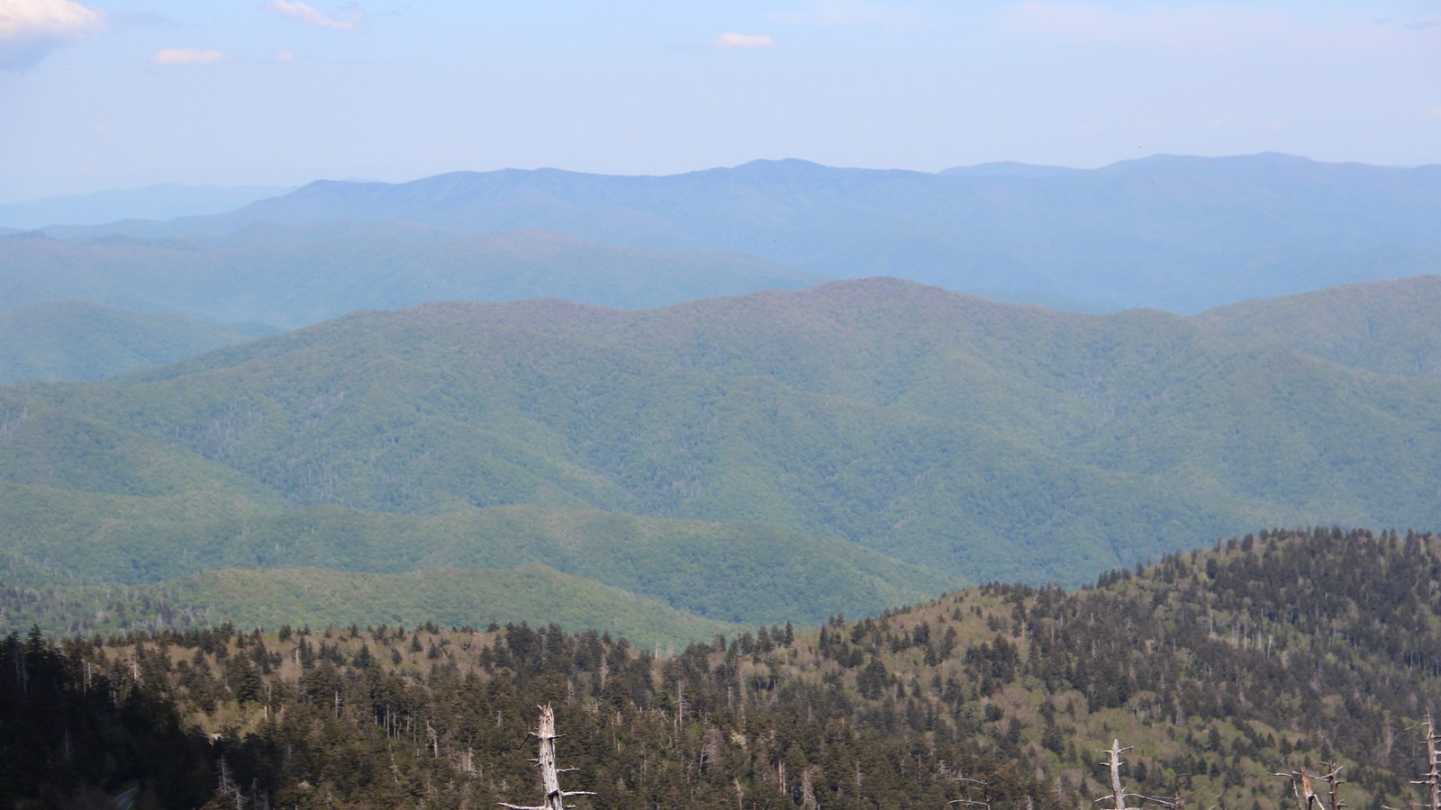
Seven classic Great Smoky Mountains hikes are open and worth your trip: Alum Cave, Charlies Bunion, Rainbow Falls, Abrams Falls, the Chimney Tops Overlook, Andrews Bald and Gregory Bald, with National Park Service distances from 2.6 to 11.4 miles round trip. The famous eighth is not open at all: Laurel Falls has been closed for rehabilitation since January 2025 and the Park Service currently anticipates reopening sometime in 2027. Add the rules that actually govern a visit, no entrance fee but a parking tag for every car, and backcountry permits on Recreation.gov at USD 8 per person per night plus a USD 6 fee, and you have the whole picture the closure rumours obscure.
The previous version of this guide was built on a closure system that does not exist. It cited a park bear-activity heatmap for 2026, a GPS-collaring dashboard tracking 120 bears, QR-code permit forms at trailheads and an NPS app updating closures every 30 minutes; none of these exists on any National Park Service channel, and closures in this park are published as a plain text alerts list. It also sent you to Laurel Falls, which is closed, put Abrams Falls at 90 feet (that is Hen Wallow Falls; Abrams Falls is 25), started two trails at trailheads they do not have, and measured Gregory Bald from the wrong side of the park. This rebuild takes every distance, status and fee from the National Park Service itself.
The seven hikes at a glance
| Hike | Distance (NPS, round trip) | Trailhead | The honest status note |
|---|---|---|---|
| Alum Cave Trail to the bluffs | 4.6 miles | Alum Cave Trailhead, Newfound Gap Road (US 441) | Open; continue to Mount LeConte for a 10-mile round trip |
| Charlies Bunion via the Appalachian Trail | 8 miles | Newfound Gap Overlook, US 441 | Open; the classic high-elevation AT walk |
| Rainbow Falls | 5.6 miles | Rainbow Falls Trailhead, Cherokee Orchard Road | Open; about 1,500 feet of gain per NPS; LeConte lies 6.7 miles one way from the same trailhead |
| Abrams Falls | 5 miles | Abrams Falls Road, off the Cades Cove Loop Road | Open; the falls are 25 feet, and swimming is strongly discouraged for a deadly undertow |
| Chimney Tops Overlook | 3.5 miles | Chimney Tops Trailhead, Newfound Gap Road | Open to the overlook only; the summit pinnacles have been closed since the 2016 fire |
| Andrews Bald via Forney Ridge | 3.6 miles | Kuwohi parking area | Open in the Kuwohi Road season (1 April to 29 November in 2026); the climb back is the work |
| Gregory Bald via Gregory Ridge | 11.4 miles | End of Forge Creek Road, Cades Cove | Open; the long day, famous for flame azaleas in late June |
| Laurel Falls | NOT OPEN | Fighting Creek Gap Road | Closed since 6 January 2025; reopening anticipated sometime in 2027 |
1. Alum Cave Trail, the park's signature half-day
The Alum Cave Trailhead sits on Newfound Gap Road, and the trail climbs 2.3 miles through Arch Rock to the Alum Cave Bluffs, a towering concave cliff that is not a cave at all: 4.6 miles round trip. It is the most varied short hike in the park, stream, rock arch, bluffs and views in one ascent. Strong hikers continue past the bluffs to the summit of Mount LeConte, 6,593 feet, which the Park Service calls the tallest, though not the highest, mountain in the East; at 10 miles round trip this is the shortest of the five routes up LeConte, and it turns a half-day into a full one.
2. Charlies Bunion, the Appalachian Trail classic
From the Newfound Gap Overlook on US 441, the Appalachian Trail runs east along the state-line ridge for 4 miles to Charlies Bunion, a bare rock outcrop with the park's most celebrated view: 8 miles round trip. Because it starts at 5,000 feet, it delivers high-elevation walking without a valley climb, through spruce-fir forest that feels like Canada. It is exposed and rocky at the end, and it is the hike on this list where weather changes fastest; Newfound Gap is the park's weather hinge.
3. Rainbow Falls, and the long way to LeConte
The Rainbow Falls Trailhead is on Cherokee Orchard Road above Gatlinburg, and the trail climbs about 1,500 feet over 2.8 miles to the falls: 5.6 miles round trip. Rainbow Falls is the trailhead for the longest day on this list, too: Mount LeConte lies 6.7 miles one way from the same start, so the falls work both as a destination and as the first act of a summit day. Note for planners: the park also closes the Bullhead Trail, another LeConte route from the same road, on weekdays for trail work (in 2026, Monday to Thursday through 19 November), which is why checking current alerts matters even for famous trails.
4. Abrams Falls, the Cades Cove waterfall
Cades Cove's waterfall hike starts from the Abrams Falls Trailhead, off the 11-mile one-way Loop Road between sign posts 10 and 11, and runs 5 miles round trip to Abrams Falls. Two corrections to common write-ups belong here. The falls are 25 feet high, not the 90 feet older guides (and the previous version of this article) claim; and the inviting pool at its base is dangerous, with an undertow the Park Service warns has been deadly, so swimming is strongly discouraged. Pair the hike with the loop itself: in 2026 the Loop Road's vehicle-free Wednesdays ran from 6 May to 30 September, an established pattern worth checking for your year.
5. Chimney Tops, the hike that ends early on purpose
The Chimney Tops Trailhead is on Newfound Gap Road about 7 miles from the Sugarlands Visitor Center; it does not start at Newfound Gap, whatever older versions say. The hike is 3.5 miles round trip to the Chimney Tops Overlook, and the ending needs stating plainly: the summit pinnacles have been closed to all public use since the November 2016 Chimney Tops 2 fire, the trail is closed at the 1.75-mile mark, and the topmost quarter mile, the pinnacles, the connecting ridge and the unofficial Manway route are all off limits until further notice, in the Park Service's words, do not go past the gate. What you get instead is a steep, satisfying climb to an observation point built below the summit in 2017, with the pinnacles in view. It is a good hike. It is not a summit.
6. Andrews Bald, from the park's highest point
Kuwohi, at 6,643 feet, is the highest point in the park and in Tennessee, and the third-highest summit east of the Mississippi; in September 2024 the U.S. Board on Geographic Names restored its Cherokee name, Kuwohi, meaning mulberry place, at the request of the Eastern Band of Cherokee Indians, replacing the name Clingmans Dome. From the Kuwohi parking area, the Forney Ridge Trail descends 1.8 miles to Andrews Bald, a grassy bald with the finest picnic view in the park: 3.6 miles round trip, and the descent-first profile means the climb back to the car is the strenuous part. Access follows the Kuwohi Road season, 1 April to 29 November in 2026. While you are up there, the short paved path to the Kuwohi observation tower starts from the same parking area.
7. Gregory Bald, the long azalea day
Gregory Bald is reached from the Cades Cove side, not from Cosby: the Gregory Ridge Trail starts at the end of Forge Creek Road and climbs 5 miles to Rich Gap and on to the bald, 11.4 miles round trip in the Park Service's listing, a 7 to 8 hour day through old-growth tulip trees. The bald is famous for its flame azaleas, which peak in late June and draw photographers from across the East. Campsite 13 near the top makes it the natural overnight on this list, on a backcountry permit, and the distance makes it the one hike here to plan like an expedition rather than an outing.
The closed one: Laurel Falls, and what to do instead
Laurel Falls was the park's most visited waterfall trail, and it is closed. The trail shut on 6 January 2025 for a full rehabilitation: new viewing platforms, the 1963 asphalt trail repaved and widened, new signage, and about 50 additional parking spaces at the trailhead. The project, originally planned at 18 months, slipped after engineers found differing geotechnical conditions beneath the lower viewing platform, and the Park Service now anticipates reopening sometime in 2027, with no date, month or season published. The closure runs from the Fighting Creek Gap Road trailhead to the Little Greenbrier and Cove Mountain junction, and it also closes the Sugarland Mountain Trail and its parking; there are no drop-offs. For a waterfall instead, Abrams Falls and Rainbow Falls above are open, and Grotto Falls, on the Roaring Fork Motor Nature Trail (2026 season 17 April to 29 November), is the park's only waterfall with a trail passing behind it, 2.6 miles round trip; note that its trail, Trillium Gap, was under a bear warning when this guide was checked in October 2026, which is exactly the kind of status to re-verify on the park's closures page before you drive.
What else is closed, honestly and briefly
Beyond the two famous closures, the park's real closure list, checked in late October 2026, is short, specific and changeable: the Bullhead Trail's weekday closure for trail work through 19 November 2026; a handful of bear closures and one bear warning, including the Twin Creeks Trail, the Cosby Knob Shelter and campsites 5, 19, 70 and 91; and several backcountry trails and campsites still closed from Hurricane Helene damage in the Big Creek and Cataloochee direction, including the Caldwell Fork, Gunter Fork and Swallow Fork trails. Bear closures in particular are event-driven: incidents in April 2026 temporarily closed even Ramsey Cascades and Abrams Falls. The lesson is procedural, not alarming: read the park's Current Cautions and Closures page in the week of your trip, because that text list, not any app or heatmap, is where this park publishes its truth.
Fees and permits, the real matrix
There is no entrance fee to Great Smoky Mountains National Park, and there cannot be one on its main roads: a 1951 Tennessee deed for the Newfound Gap and Little River roads prohibits tolls, and federal law bars an entrance fee where tolls are prohibited. What you buy is a parking tag. Under the Park It Forward program, in place since 1 March 2023, any vehicle parked anywhere in the park for more than 15 minutes needs a tag: USD 5 daily, USD 15 weekly or USD 40 annual. The tag is physical, print it or buy it in the park; digital versions are not accepted, America the Beautiful passes do not substitute, the tag is not tied to one location, and it does not guarantee a space, which at Newfound Gap and the Kuwohi lot in October is a real consideration. All of the revenue stays in this park.
Day hikes need no permit. Overnight trips do: backcountry permits moved to Recreation.gov on 30 April 2026 and cost USD 8 per person per night plus a USD 6 non-refundable permit fee, and the old USD 40 cap is gone. Book up to a month ahead, 7 nights maximum per permit; at shelters you sleep inside the shelter rather than tenting beside it, and at ordinary campsites you may stay at most 3 consecutive nights. Appalachian Trail thru-hikers use a separate USD 44.50 permit. One more road note for drivers: Kuwohi Road ran 1 April to 29 November in 2026, and the Roaring Fork Motor Nature Trail 17 April to 29 November; winter trips should plan around the high roads being shut.
Bears and dogs, the park's own rules
The Park Service estimates about 1,900 black bears in the Smokies, roughly two per square mile, among the densest populations in the country. The rules follow from that arithmetic. Stay at least 50 yards from bears; getting closer, or staying close while a bear changes its behaviour because of you, can mean fines or arrest. In the frontcountry, food and scented items belong in a locked, hard-sided vehicle; in the backcountry they must hang on the bear cables provided at the sites, even if you also carry a canister. Feeding a bear is a federal offence carrying up to USD 5,000 and six months. Bear spray is allowed in this park under the Superintendent's Compendium, and making noise on blind corners is the park's everyday advice. The Smokies' black bears are a different animal from the brown bears covered in our guide to seeing brown bears in Europe, but the etiquette, distance, food discipline, no approach for photographs, transfers directly.
Dogs are the simplest rule in the park: leashed dogs are allowed on exactly two trails, the Gatlinburg Trail and the Oconaluftee River Trail, on a leash of 6 feet or less, and nowhere else on trail and never in the backcountry. If your trip is built around hiking with your dog, build it around those two riverside paths and the campgrounds, or board the dog for hiking days.
Sources
- National Park Service, Great Smoky Mountains: hike pages for Alum Cave, Charlies Bunion, Rainbow Falls, Abrams Falls, Chimney Tops, Andrews Bald, Gregory Bald and Grotto Falls (distances, trailheads, statuses): nps.gov/grsm
- National Park Service: Laurel Falls Trail rehabilitation releases and the Current Cautions and Closures page (closure since 6 January 2025, reopening anticipated sometime in 2027): nps.gov/grsm
- National Park Service: Fees and Passes (Park It Forward parking tags, no entrance fee and the 1951 deed) and Backcountry Permits pages (Recreation.gov since 30 April 2026, USD 8 per person per night plus USD 6 fee): nps.gov/grsm
- National Park Service and the U.S. Board on Geographic Names: Kuwohi name restoration, 18 September 2024; Kuwohi 6,643 feet, Mount LeConte 6,593 feet: nps.gov
- Superintendent's Compendium, Great Smoky Mountains National Park: Chimney Tops closure at the 1.75-mile mark, bear spray provision, pet rules: nps.gov/grsm