
You do not need a permit to hike, climb or ski in Romania's mountains: no e-permit portal, no activity passes, no QR codes exist, whatever older guides claim. What does exist is a small park visitor ticket in some protected areas (10 RON per person in Bucegi, Piatra Craiului and Retezat; nothing at all in the Fagaras, Rodna or the Apuseni, where the show caves charge separately). The six ranges that matter: Fagaras (Moldoveanu, 2,544 m, Romania's highest), Bucegi (Omu, 2,505 m), Piatra Craiului's limestone ridge, Retezat (the first national park, 1935), Rodna in the north, and the Apuseni karst with the Scarisoara ice cave. Mountain rescue is free: Salvamont on 112, or 0725 826 668 (0-SALVAMONT).
An earlier version of this guide invented an entire permit system, portal, prices and all, plus routes, grades, studies and a mountain range that does not exist. This version starts from the park administrations and Romsilva's own pages. The permit section below is deliberately short, because the truth is short.
The permit truth
There is no Romanian hiking, climbing or ski-touring permit. No portal issues one, no ranger will ask for one, and no guide needs to "handle" one for you. The complete list of what you might actually pay for, in the ranges below:
- Bucegi Natural Park visitor ticket: 10 RON per person, valid 3 months across all trails; sold online through the park and at access points.
- Piatra Craiului National Park visitor ticket: 10 RON per person, a 7-day pass; sold online and at the vending machine by Zarnesti Post Office.
- Retezat National Park visitor ticket: 10 RON per person, valid 7 days; sold at the park's entry points (Nucsoara side, Gura Apei, Pietrele) and by rangers.
- Fagaras, Rodna and the Apuseni: no general visitor fee. In the Apuseni you pay instead at the ticketed show caves, Scarisoara included.
- Cable cars, chairlifts and huts charge their own commercial prices, as anywhere in Europe.
Fagaras: the high ridge
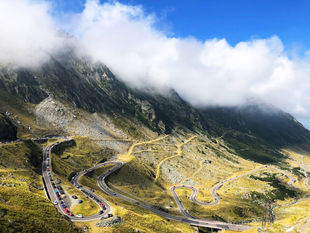
Romania's roof. Moldoveanu (2,544 m) and Negoiu (2,535 m) anchor a main ridge that strong parties traverse hut to hut in about 5 to 6 days (Cabana Podragu at 2,136 m and the Balea Lac hut are the classic nights; the full east-west crossing takes 7 to 10 days). The Fagaras is not a national park (it is a Natura 2000 site), and there is no entry fee. Most visitors meet it at Balea Lake, at 2,034 m (not 1,800 m, as some guides print), beside the Transfagarasan (DN7C), the famous pass road that snow closes for most of the year: it normally opens around the start of July (in 2025 it reopened on 6 June) and closes again in late October or early November. The red-stripe ridge trail is exposed, escapes are long, and afternoon storms are the range's standing rule: start at dawn, be off the crest by early afternoon.
Bucegi: Bucharest's mountain
The Bucegi Natural Park (established 2003, 32,500 ha) is the range the capital escapes to, by train to Sinaia or Busteni in about 2 hours. Its summit is Omu (2,505 m), but its celebrities are rocks: the Sphinx and the Babele, conglomerate formations sculpted by wind erosion, photographed far more than climbed. Cable cars from Busteni (to Babele) and Sinaia do the heavy lifting for day visitors; check the operator's current tariffs before you go, as prices change often. The park's visitor ticket is the 10 RON one described above. Come midweek if you can: on summer Sundays the plateau paths carry half of Bucharest.
Piatra Craiului: the limestone wall
One ridge, and only one: the Craiului is a single limestone crest (not sandstone) running some 25 km, topped by La Om / Piscul Baciului (2,238 m). The full ridge traverse is a serious undertaking for experienced, well-equipped hikers, narrow and exposed in places, with no water on the crest. Base yourself in Zarnesti (trains from Brasov), walk in through the Zarnesti Gorges, and use Plaiul Foii on the western side for the classic ascents. Visitor ticket: 10 RON for 7 days, online or from the machine by the Zarnesti Post Office.
Retezat: the first national park
Romania protected Retezat first, in 1935; it has been a UNESCO Biosphere Reserve since 1980, and it feels a step wilder than the Bucegi. The high point is Peleaga (2,509 m); the heart is Lake Bucura at 2,040 m, the largest glacial lake in Romania at about 8.9 hectares, ringed by more than fifty smaller tarns. Rules are real here even if permits are not: camp only in the designated sites, make fires only where permitted (Poiana Pelegii), and leave the Gemenele Scientific Reserve alone entirely (entry only with written Romanian Academy permission). Visitor ticket: 10 RON for 7 days. Access runs from the Hateg side through Nucsoara.
Rodna: the quiet north
The Rodna range guards the Maramures border, and its summit, Pietrosul Rodnei (2,303 m), is the highest peak in Romania's Eastern Carpathians. Its showpiece is water, not rock: Cascada Cailor, about 90 metres in stepped drops, Romania's tallest waterfall, reached by chairlift from Borsa and then about 30 minutes on foot. No visitor fee for Rodna's park was published anywhere we could find, and hikers report walking in freely; carry small cash anyway, as with everywhere in rural Romania, and do not believe any site that tries to sell you a Rodna permit in advance.
Apuseni: the karst and the ice cave
The Apuseni Natural Park is limestone country: dolines, gorges, cave systems and villages on high plateaus. General access is free; the caves charge their own tickets. The famous one is Scarisoara, home to one of Europe's largest underground glaciers: about 75,000 m3 of ice in a chamber visited on guided group tours, where the temperature hovers around 0 degrees C all year (it is neither the deepest ice cave in Romania nor minus 3, whatever older guides say; it is colder in impression than in fact, so take the jacket anyway). Nearby, the Cetatile Ponorului system, a fortress of sinkholes and an underground river, is the range's other great day out.
And one gorge: Bicaz
On the road east, the Bicaz Gorges (Cheile Bicazului) cut about 8 km through the Hasmas mountains in walls up to 300 m: a national park, a real and long-established sport-climbing area, and a drive nobody forgets. Beside it sits Lacul Rosu, the Red Lake, formed in 1837 when a landslide dammed the valley, its drowned pine trunks still standing in the water. Climb here with a current local topo, not with route names from the internet, including our old article's, which were invented.
Safety: bears, dogs and rescue
Romania holds Europe's largest brown bear population outside Russia, and the Carpathians are working mountains, not a theme park. The practical rules are few and absolute: never approach or feed a bear, keep food sealed at huts and camps, and make noise on forest trails. Our guide to where to see brown bears in Europe covers Romania's bear country, including the Brașov-area hides, in depth. The second hazard wears a collar: shepherds' guardian dogs defend their flocks aggressively. Stop, stand still, keep your sticks down, and let the shepherd call them off; do not run and do not shout at the dogs. Weather comes from the National Meteorological Administration (meteoromania.ro), whose mountain forecasts and warnings are the ones the locals use. If it goes wrong anyway: Salvamont, Romania's mountain rescue, is a free public service, reached on 112 or directly on 0725 826 668 (0-SALVAMONT). Trails are marked with the Romanian blaze system (painted stripes, triangles and dots on trees and rocks); the red stripe follows the main ridges, and a charged phone plus an offline map remains the cheapest safety device in the country.