
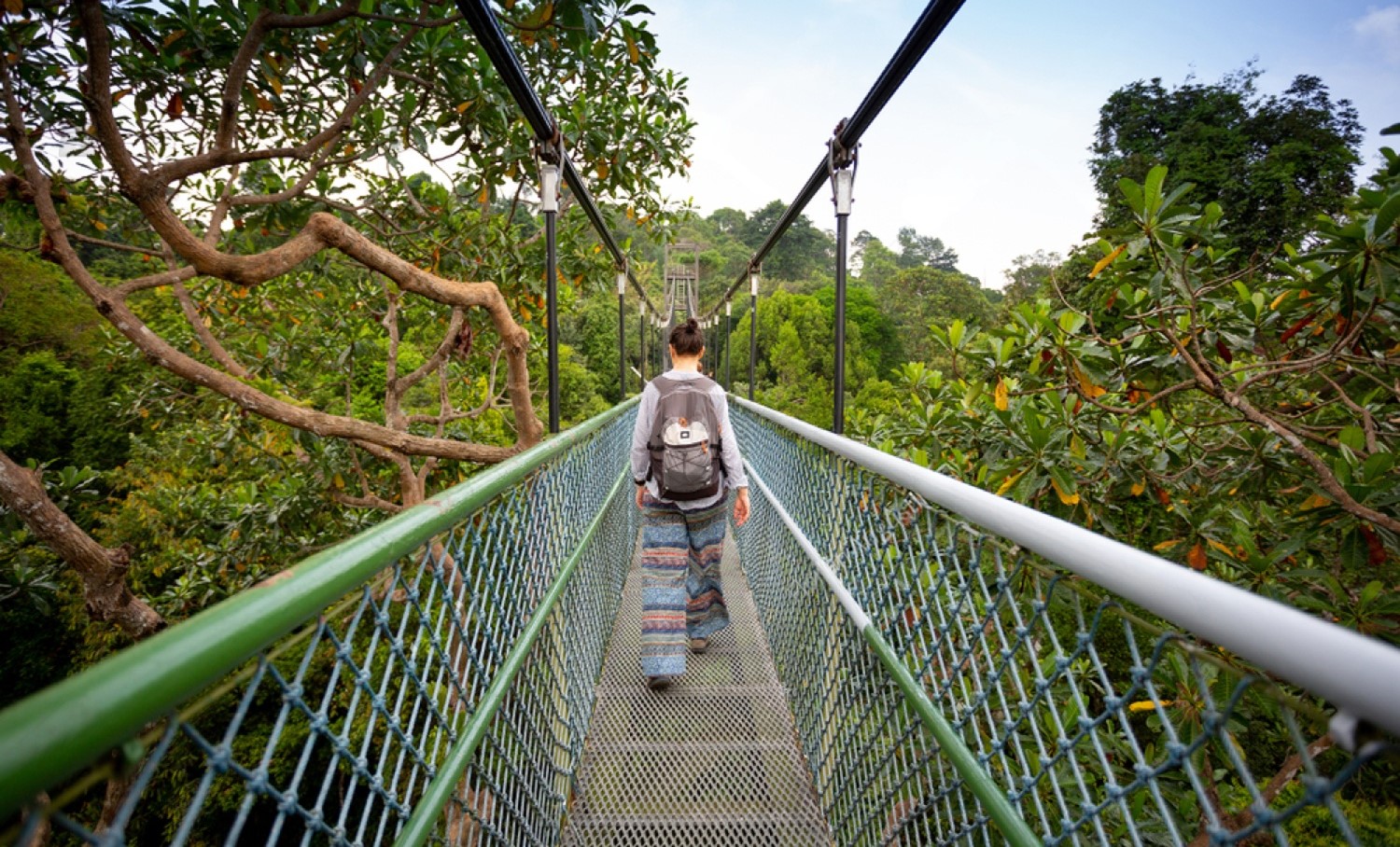
Singapore's best hike is the MacRitchie TreeTop Walk in the Central Catchment Nature Reserve: a 250 m suspension bridge 25 m above the forest, reached by a 4.5 km trail. Bukit Timah climbs to the island's highest natural point at 163.63 m, the Southern Ridges link 10 km of ridges and bridges across the south, and Pulau Ubin's Chek Jawa boardwalks cross six habitats in one walk. The nature reserves open 7am to 7pm, and there is no live trail-status app: check the NParks website for closure notices before you go.
For a city-state 50 km wide, Singapore hides a serious amount of forest: over 2,000 hectares of primary and secondary rainforest in its central catchment alone, a summit, mangrove boardwalks and an offshore island that still runs on village time. This guide covers the hikes that are actually worth your weekend, with distances, hours and transport checked against NParks, and with the accessibility notes told straight, because several of these trails are routinely misdescribed online. Everything is free unless stated; Singapore's nature reserves and parks do not charge entry.
Singapore hiking at a glance
| Hike | Distance | Character | Nearest MRT |
|---|---|---|---|
| MacRitchie TreeTop Walk | About 9 km return (4.5 km each way) | Forest trail to a one-way canopy suspension bridge | Marymount / Caldecott |
| Bukit Timah summit | About 1.3 km each way | Short, steep, stepped climb to 163.63 m | Beauty World |
| Southern Ridges | About 10 km end to end | Ridge walkways, Henderson Waves, harbour views | HarbourFront |
| Chek Jawa, Pulau Ubin | 1.1 km of boardwalks (island trails beyond) | Coastal and mangrove boardwalks; intertidal flats at low tide | None: bumboat from Changi Point |
| Coney Island | About 2.5 km across | Flat rustic island park, beaches and mangroves | Punggol (then bus/LRT) |
| Sungei Buloh | Loops from 300 m to about 2 km | Wetland boardwalks and hides, migratory birds Sep-Mar | Kranji (then bus 925) |
MacRitchie and the TreeTop Walk
The Central Catchment Nature Reserve is the green heart of the island: more than 2,000 hectares wrapped around the reservoirs, with over 20 km of trails, open 7am to 7pm daily. The signature walk starts at MacRitchie Reservoir Park (off Lornie Road; Marymount and Caldecott MRT stations are the practical arrivals, with a bus or short walk to the park entrance) and follows the Petai Trail and Peirce Track about 4.5 km each way to the TreeTop Walk.
The bridge itself is a free-standing suspension walkway about 250 m long, hung up to 25 m above the forest floor between Bukit Peirce and Bukit Kalang. It is one-way only: you cross, then loop back on the trails below, which is why the return is a route, not a retrace. Its hours are narrower than the reserve's: Tuesday to Friday 9am to 5pm, weekends and public holidays 8:30am to 5pm, closed on Mondays (except public holidays), and it can close in bad weather, so a Monday plan or a stormy afternoon needs a Plan B. The full reservoir loop via the Lornie Trail runs about 10 to 11 km for those who want the long version, and the Jelutong Tower adds a canopy-level lookout on the way.
Two MacRitchie rules matter. The long-tailed macaques here are bold and practised: NParks' advice is to keep plastic bags out of sight (monkeys associate them with food), never feed any wildlife (it is illegal across Singapore), and walk calmly away from any monkey that approaches. And the reserve keeps hours: trails are for 7am to 7pm, and being in a closed nature reserve area carries fines of up to $2,000.
Bukit Timah: the summit, and its gentler neighbours
Bukit Timah Nature Reserve protects 163 hectares of Singapore's last primary rainforest around the island's highest natural point, 163.63 m. The main summit route from the visitor centre (nearest MRT: Beauty World on the Downtown Line, about 800 m away) is only about 1.3 km, but it earns it: paved at first, then properly steep, with a stepped shortcut section near the top, and realistically 30 to 45 minutes up. It is a genuine little climb, not a stroll, and it is not wheelchair accessible: NParks lists wheelchair access at Bukit Timah only around the visitor centre's exhibition halls and toilets, and no ramp changes what the summit path is.
The same corner of the island holds three easier options that families actually use. Hindhede Nature Park (9.5 ha), right beside the Bukit Timah visitor centre, has a short, gentle path to a lookout over the flooded Hindhede Quarry. Dairy Farm Nature Park (about 75 ha) offers the 2.2 km Wallace Trail through secondary forest to the Singapore Quarry. And Rifle Range Nature Park (66 ha, opened in November 2022 as Singapore's first net-positive-energy nature park) adds over 7 km of trails, a restored freshwater wetland and the Colugo Deck, a 31 m lookout over the reservoir. All keep the same 7am to 7pm reserve hours.
The Southern Ridges
The Southern Ridges stitch five parks into one continuous walk of about 10 km from West Coast to HarbourFront, and it is the best half-day walk in the city. West to east, the pieces are Kent Ridge Park, HortPark, the 280 m elevated Canopy Walk, Alexandra Arch (80 m), the Earth Trail and Forest Walk up Telok Blangah Hill (the Forest Walk runs 1.3 km through the canopy), then the centrepiece: Henderson Waves, at 274 m long and 36 m above Henderson Road the highest pedestrian bridge in Singapore, its wave ribs sheltering seats in the curves. From there the Marang Trail descends to HarbourFront MRT.
Accessibility, honestly: the elevated walkways and Henderson Waves themselves are smooth and step-free, which is why this walk gets recommended so widely, but the full 10 km is not step-free end to end. The Marang Trail at the HarbourFront end is about 800 m of steps, and there are stepped sections elsewhere. Wheelchair users and stroller-pushers do best on the central sections (Forest Walk, Henderson Waves, Canopy Walk) accessed from the hilltop roads, not the full traverse.
Pulau Ubin and Chek Jawa
Pulau Ubin is Singapore as it was: a granite island of kampongs, quarries and mangroves, reached by bumboat from Changi Point Ferry Terminal. The boats keep village rules: SGD 4 per person each way (plus SGD 2 per bicycle), cash only, no timetable, departing when about 12 passengers have gathered, 10 minutes across. There are no ATMs on Ubin, so the cash point is not a detail.
At the island's eastern tip, Chek Jawa Wetlands packs six habitats (mangrove, sandy beach, seagrass lagoon, coral rubble and more) into about 100 hectares, with 1.1 km of boardwalks on two loops, coastal and mangrove, plus the 21 m Jejawi Tower for a canopy view. The boardwalks work at any tide between 7am and 7pm. The famous intertidal flats are different: they are only exposed at low tides of 0.5 m and below, so an intertidal walk is a tide-table exercise (NParks publishes the suitable dates), and the flats are walked carefully, on the sand, never on the seagrass. Inland, Puaka Hill (74 m) is the island's high point, Ketam Mountain Bike Park runs about 10 km of graded trails, and the village rents bicycles by the day. NParks' guided Chek Jawa walks book out fast and occasionally pause for maintenance, so check the NParks page for the current status before planning around one.
Coney Island and the long routes
Coney Island Park, off Punggol, is 81 hectares of deliberately rustic park: casuarina forest, five beach pockets, mangrove boardwalks and a 2.5 km main path, gates 7am to 7pm, no camping and no fishing. Our linked pillar guide covers its entrances, the Punggol Coast MRT arrival and its bird hides in full.
Two long-distance routes anchor the island's walking map. The Coast-to-Coast Trail runs 36 km from Jurong Lake Gardens to Coney Island through the central parks. The Rail Corridor follows the former Malaysian railway line for 24 km north to south, a flat green spine best walked in sections from its access points. And in the north-west, Sungei Buloh Wetland Reserve (202 ha) is the birdwatcher's park: boardwalks, mudflats and observation hides, at its best in the migratory season from September to March, reached via Kranji MRT and bus 925, with a 6:30pm last entry. NParks flags Sungei Buloh's main routes as wheelchair accessible, one of the few nature sites in this guide where that is officially the case.
Rules, weather and honest accessibility
- Hours are enforced: nature reserves and Coney Island run 7am to 7pm. Plan to be out by 7pm; the reserves are not lit and are not night spaces.
- Closures: there is no NParks live trail API and no official trail app (an app called ParkGuru, sometimes recommended by older websites, is not an NParks product). Trail closures and works are posted as notices on the park pages at nparks.gov.sg and on NParks' social channels. Check the specific park page on the morning you go.
- Thunderstorms are the real hazard: Singapore averages about 176 lightning days a year (Meteorological Service Singapore), with storms favouring the afternoon. NParks' rule is plain: do not enter the reserves in bad weather, and get to shelter when a storm builds. Morning starts are the local habit for a reason.
- Heat: it is 27 to 33 degrees with high humidity in every month. Carry at least a litre of water (coolers exist at the main trailheads, not on the trails), and treat any hike here as a hot-climate hike, whatever its distance.
- Wildlife: no feeding (illegal island-wide), no dogs inside the nature reserves, stay on the trails and boardwalks in the reserves, and give macaques and wild boar a wide, calm berth.
- Accessibility, in one place: officially wheelchair-accessible: the MacRitchie Reservoir Park promenade area (not the TreeTop Walk trail), the Bukit Timah visitor centre area (not the summit), Sungei Buloh's main routes, and smooth central sections of the Southern Ridges. Not step-free: the TreeTop Walk route, the Bukit Timah summit path, the Marang Trail, and Coney Island's rustic paths. When in doubt, the NParks page for each park states its access plainly.